
|
|
|
|
|
|
|
|
|
|
|
Photos Scanned And Provided By: Mustafa Pirmohamed
![]() to Lindi Notes - General
Main Page
to Lindi Notes - General
Main Page
Lindi
Notes - General - Geography
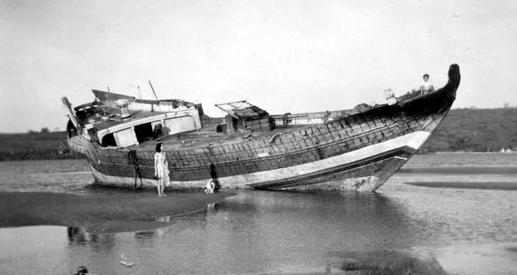
1952 - Cyclone in Lindi - An abandoned dhow from Kutch, India at Rasbura Lindi.
It carried Mangalore roofing tiles for Lindi Hospital under construction. The
cyclone resulted in many roofs to be blown off in Lindi Town.
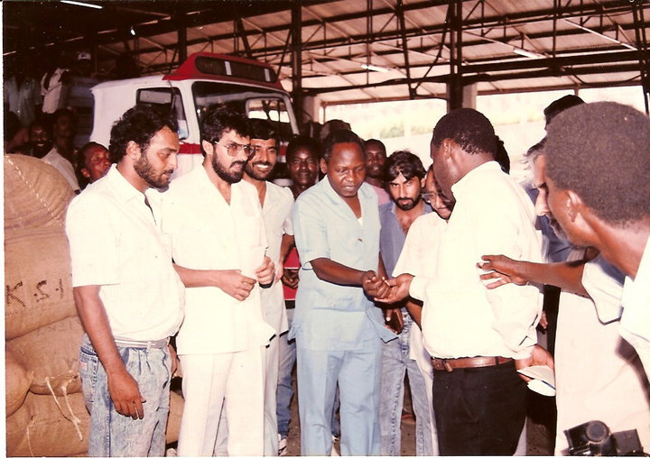
1992 - Lindi Floods - Donation by Dar KSI Jamat Picture shows Aliraza Rajani -
President; Mustak Fazal, Ebrahim Ladhu, Hussein Dhanji and Zulfikar Visram
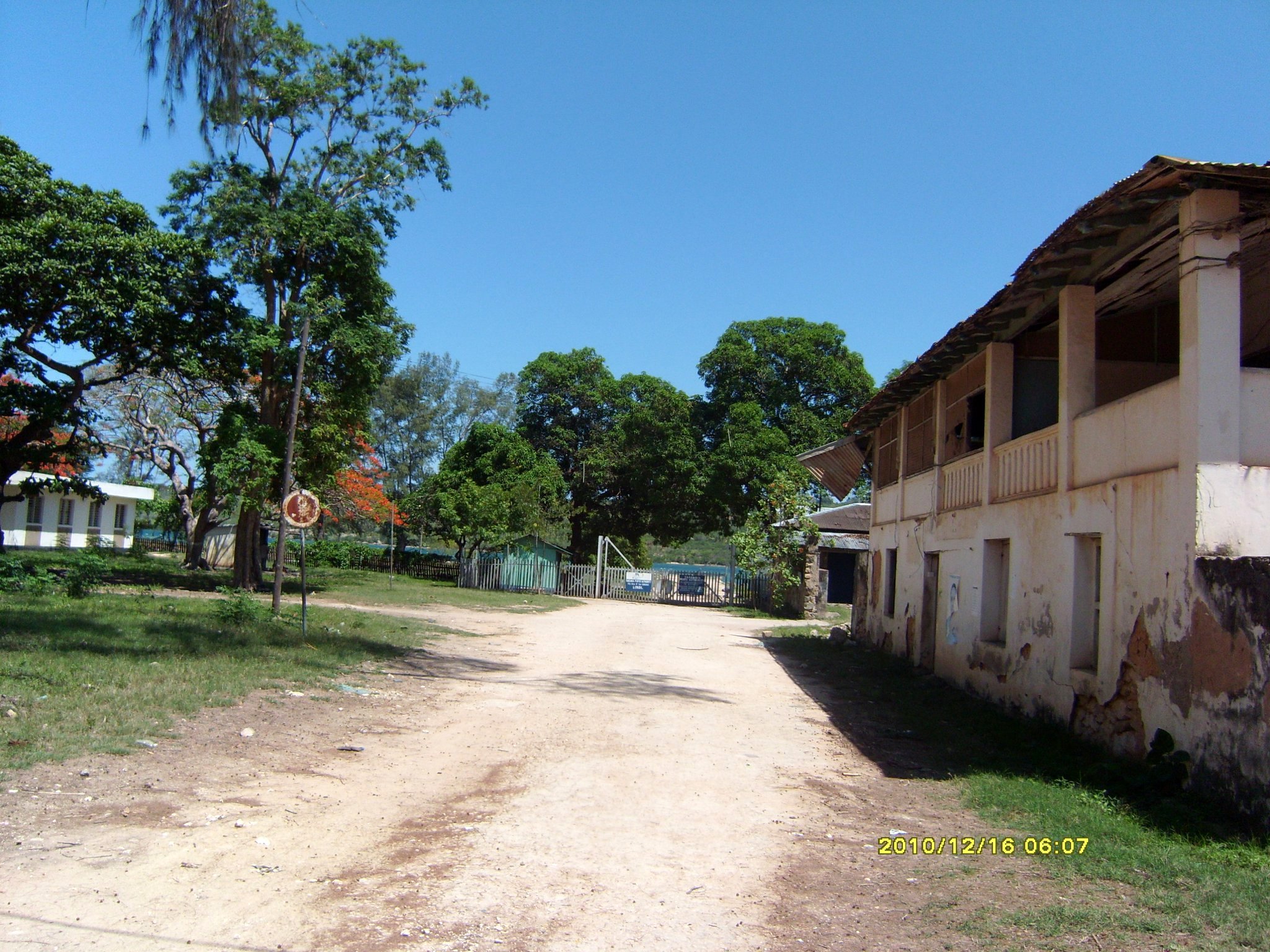
2010 - Road to the port near Makumbusho
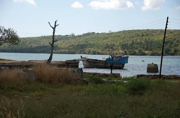
2010 - Lindi Port (photo by Sameer Kermalli)
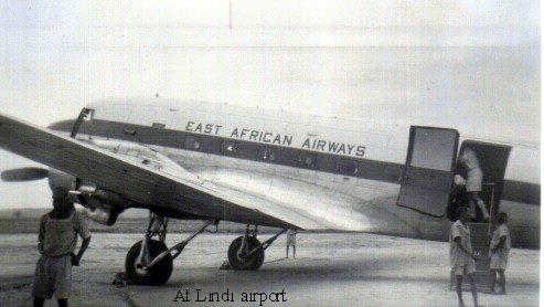
1957 - Dakota at Lindi Airport (
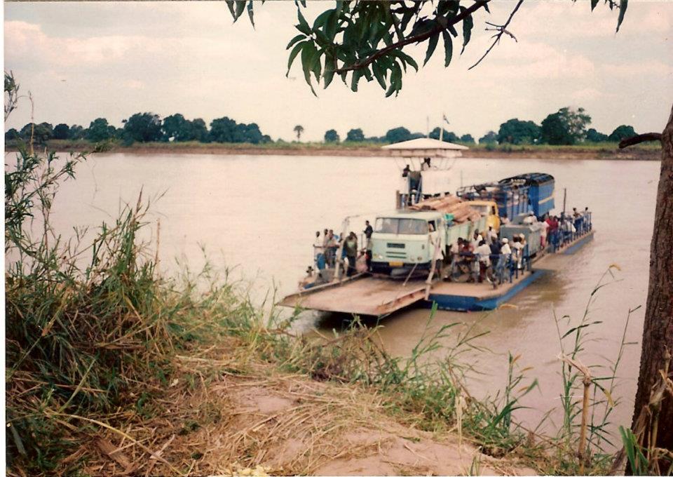
1993 - Ferry over Rufiji
Geography &
Administration
Lindi means a depression in Swahili or Makua (the local tribal language) – It
was so called because it is in a depression and surrounded by hills - Kitunda,
Wireless, Mtanda, White Hill and Mmongo.
Lindi Town lies at
Latitude 10 deg South and Longitude 39 deg East, It is believed that the centre
of town is actually below sea level; hence the move to build government and
other offices at Wireless Hill.
The region has 6 Districts:
Lindi Urban, Lindi Rural, Liwale, Kilwa, Ruangwa, Nachingwea.
Lindi Urban (Town) has 13 wards:
Ndoro, Makonde, Mikumbi, Mitandi, Rahaleo, Mwenge, Matopeni, Wireless,
Nachingwea, Rasbura, Mtanda, Jamhuri, Msinjahili
Lindi is a coastal town located at the far end of the Lindi Bay, on the Indian
Ocean in southeastern Tanzania. The town is 450 kilometers south of Dar es
Salaam and 105 kilometres north of Mtwara, the southernmost coastal town in
Tanzania, and gives its name to the surrounding Lindi Region, one of the most
sparsely populated areas of the country. The town population was 41,549 as of
the 2002 national census.
Lindi is located at the mouth of the Lukuledi River. Its port facilities are
still rudimentary, allowing one or two small cargo and passenger boats at a
time, and cannot accommodate ocean-going ships. The region was once an important
sisal-producing plantation area, especially Kikwetu, which surrounded the Lindi
airstrip, 25 kilometres north of town.
Source:
http://en.wikipedia.org/wiki/Lindi#External_lines
Transport and
Communication
Transport is one of the greatest problems for Lindi. The road from Dar to Lindi
has finally been constructed after nearly 40 years since it was first discussed
about. The bridge over the Rufiji River is called Mkapa bridge. There is still a
60 km patch on this road which has to be paved. One of the reasons for the poor
development of Lindi has been the lack of proper transport. It is also believed
that the building of deep-water harbour at Mtwara in 1954 and the collapse of
the Groundnut Scheme in 1951 during the British era all contributed to the economic
decline of Lindi.
Air transport is unreliable. Sometimes Lindi airport remains closed for months
in the absence of scheduled flights.
In 1950s East African Airways had daily flight starting from Nairobi. There was
one flight going to Durban passing through Lindi. Also there was one flight once
a week passing through Mbeya, Iringa, Njombe and Songea. It used to bring fresh
vegetables for Lindi people. (Source: Jayanti Patel)
I remember those days of air travel when if one wanted to fly from Lindi to Dar,
the flight would take us to Kilwa first. All of us would be told to disembark at
Kilwa where we would take rest at the airport and then re-embark onwards for the
journey to Dar. I think the planes were called Dakota. Relaxed life!
Following the collapse of EAA, Air Tanzania took over. Then we had Eagle Air,
Precision Air and others during the last 30 years. Air traffic from Dar is now
mostly diverted to Mtwara. Too bad for those wishing to go to Lindi directly!
Lindi port used to have passenger ships like MV Mombasa which used to anchor far
from the jetty. Passengers then had to travel by motorboats to get into the
ships. The smaller motor schooners which brought cargo from Dar and other ports
used to anchor at the jetty. The two nearest small ports are Mingoyo which was
used during first World War by residents of Lindi to flee in boats from Lindi
when they feared attacks. The other port is at Mkoe-Rushungi - which was mainly
used to load sisal which was brought to Lindi.
Telephones
The earliest phone
was the cranking type - we used to call it ice-cream machine. If you wanted to
call someone, you would crank, round and round and round, for the operator to
respond. The cranking would go on for a long time if the operator was some lazy
fellow. You gave him a number - starting from 1 to 300 - these were the number
of phones in Lindi. He would then connect you – this would be at his discretion.
If you were a friend, he might connect you fast.
There was this system of reverse charge call. You told the operator to connect
you to a distant call - STD call - Standard Trunk Dialling and tell them that
the charge would be paid by the receiving person. One particular incident where
this system was abused was amusing. A person travelled to Dar and made a reverse
charge call to Lindi to inform that he had reached Dar. Now, in order to save
money, he told the operator that his name is Ponchi Gayo (meaning he has already
arrived - in Gujarati). The operator would ask the Lindi guy whether he was
ready to bear the reverse charge call from someone called Ponchi Gayo. He
refused the call, but got the message!
![]() to Lindi Notes - General
Main Page
to Lindi Notes - General
Main Page
| Last updated August 2012 | Copyright © Mahmood Fazal 2005 - All Rights Reserved |
Created By Husain Fazal |